The Canyons District Technology Endorsement cohorts recently participated in a week long hands-on Community Mapping class. Throughout the week, the participants covered three basic ideas:
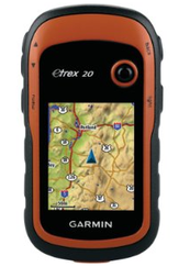
1. The participants learned how to use a Garmin GPS Device.
Below are examples of some of the projects the participants completed in this course. Each project built on the skills of the prior project.
1. The participants learned how to use a Garmin GPS Device.
- Track Points
- Mark Waypoints (with averaging)
- Find Waypoints/Geocache
We discussed how geocaching can be used to enhance the curriculum. Click here to see some of our ideas. Feel free to add to the list! - etc., etc., etc.
- http://www.esri.com/
- http://www.esri.storymaps.com
- http://www.arcgis.com/
- http://resources.arcgis.com/
- http://cmap.maps.arcgis.com
- www.worldmapper.org
- Mark Waypoints
- Import into Garmin Basecamp
- Export as .csv file
- Open .csv file in Excel and add other info as desired (more info about the specific location/waypoint, such as a picture link).
- Resave .csv file
- Import the .csv file onto a new map on arcgis.com
- Customize the map
Below are examples of some of the projects the participants completed in this course. Each project built on the skills of the prior project.
Track Your Initials Project- Created by: Karen Davis
For this project, the students learned how to use their GPS to track their initials in the field. They recorded their tracks on the GPS, and then created a map.
Tree Mapping Project- Created by: Ann Simonds
The tree project allowed the students to take the process a step farther by adding extra information to the map. The students went around and collected information about the trees in their assigned area, compiled it into a spreadsheet, then created a map.
Water Shed Project- Created by: Jenny Dompier
The watershed project gave meaning to the mapping. It allowed the participants an opportunity to create a story map. The students went on a field trip, where they collected water samples and other information at five different locations of Little Cottonwood Creek. Then, they compiled the information and again mapped it.
 RSS Feed

