EdTech
  • Welcome!
  • Assessment
    • AAPPL
    • Data Dashboard
    • SAGE Science Information
    • SAGE Math Information
    • SAGE Summative >
      • SAGE Language Arts Information
      • SAGE ELL Information
    • Utah Compose
    • GradeCam
    • Nearpod
    • Pearson Realize >
      • Pearson Realize for Students and Families
      • Pearson enVision 2.0 for Teachers
  • Technology PD
    • Ed Tech Endorsement >
      • Ed Tech Certifications
    • PD Registration
    • Professional Development - ESP
    • UCET
    • 12 Days of Ed Tech Winter
  • Parent Connections
  • Hour of Code
  • Teacher Resources
    • Digital Citizenship Week
    • Keyboarding
    • Annual Canyons District Film Festival >
      • About the Film Festival
      • Film Festival Categories
      • Preparing for the Canyons District Film Festival
      • The Filmmaking Process
      • Film Festival Teacher Resources
      • Film Festival Poster Contest
      • Film Festival American Graduate Strand
      • Other Filmmaking Opportunities
    • Instructional Technology Toolbox >
      • Positive Behavioral Interventions and Supports (PBIS)
  • Contact Us
    • Who do I ask?

Google Earth

Picture
Google Earth is a virtual globe browser, arguably the most popular of those available for free on the Internet. Google Earth allows users to interactively display and investigate geographic data (primarily satellite and aerial images and terrain models, but also 2- and 3-D vector data such as earthquake locations, water bodies, and buildings).

Google Earth also allows users to perform some basic measurements such as: latitude and longitude, elevation, and size. Google Earth lets you fly anywhere on Earth to view satellite imagery, maps, terrain, 3D buildings, from galaxies in outer space to the canyons of the ocean. You can explore rich geographical content, save your toured places, and share with others.

Introduction to Google Earth


Google Earth Tutorial

Uses:

  • Virtual field trips
  • Realistic view of the earth

Limitations:

  • Need an internet connection

Documentation:

task_card_1_googleearth.doc
File Size: 29 kb
File Type: doc
Download File

How to:
  • ​Getting Started
  • ​Downloading and installing
  • Navigation
  • Changing Views
  • Navigating sky
  • ​Finding Places and Getting Directions​​
  • Drawing and Measuring
  • Using Layers ​​
  • Marking and Saving Places
  • ​Making Tours and Movies​

Links:

  • http://www.gearthblog.com/
  • http://googlesightseeing.com/
  • http://www.juicygeography.co.uk/googleearth.htm​
  • Google Earth Educational Gallery
  • Google Earth Lessons

Google Lit Trips

Picture
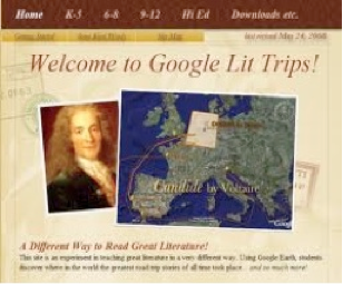
A really cool idea using Google Earth is to take students on tours of literature. Google Lit Trips focuses on individual books (such as The Odyssey) and where those books take us. You can download pre-made maps (some examples are Night, Kite Runner, and of course, The Odyssey).

Of course, you can also create your own lit trip using Google Earth. Just add a few points, connect them with lines and/or arrows, and go on a virtual tour of Earth.

http://www.googlelittrips.com/GoogleLit/Home.html

Video Introduction of Google Literature Trips

Rev: DPR 10/2015
Powered by Create your own unique website with customizable templates.


Our mission is to improve teaching and learning through the use of appropriate technologies,
supporting students in their progress toward college-, career-, and citizenship-readiness.

Creative Commons License

Original content distributed on this website is licensed under a
Creative Commons Attribution-Noncommercial-Share Alike 3.0 United States License.